






Sensors › Weather Radar
Sensors
Weather Radar
Seeing a squall while there is still time to do something about it.
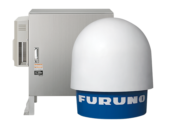
A squall can arrive as a step change in wind rather than a gradual build, and the warning time is the difference between securing a lift calmly and stopping one in a hurry. The Furuno WR2120 watches weather cells approach from up to 70 km away, with a full volume scan every minute, so the crew can see weather coming long before it reaches the deck.
Powered by ![]()

What a weather radar adds
Every other sensor on an installation measures what is happening at the installation. A weather radar measures what is happening seventy kilometres away and heading towards it. That is the whole point of it: an event that would otherwise arrive without warning becomes one you can see coming.
An X-band Doppler radar sends out a pulse and reads what returns from rain and hail in the air. Two measurements come back:
- Reflectivity (dBZ): how intense the precipitation is
- Doppler velocity (m/s): how fast it is moving towards or away from the radar
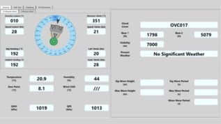
Together they give a live picture of where showers and storm cells are, how strong they are and where they are heading. We bring that picture into DADAS, so it is shown and logged alongside wind, waves and the rest of the weather data on the installation.
What the rain map shows
Rain on the map
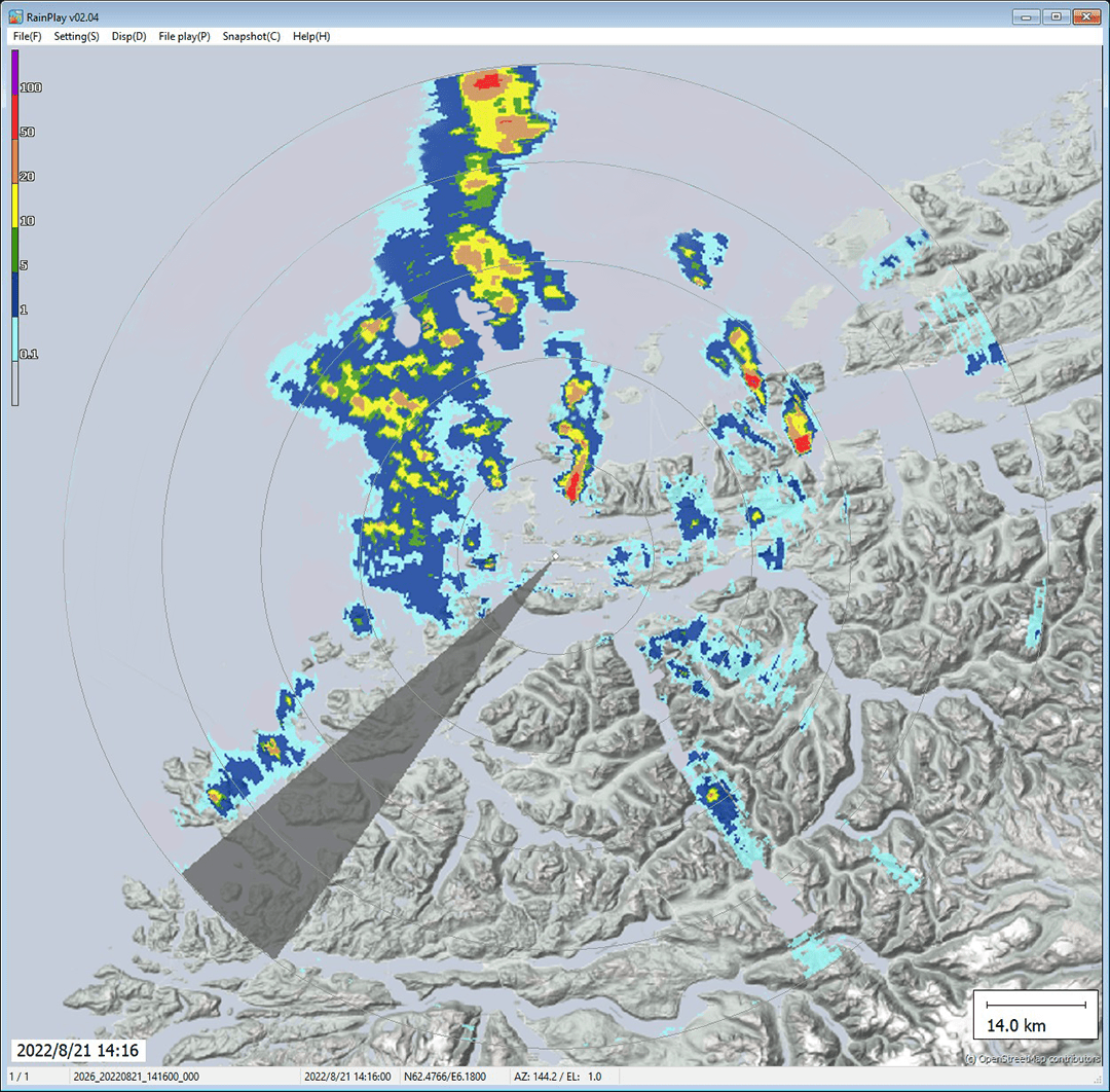
Precipitation plotted over the coastline and open sea around the radar, out to about 70 km.
Intensity in colour
A colour scale shows how heavy it is, from light rain in blue to the heaviest in red.
Rainfall rate
Intensity converted to rainfall rate in mm/h, for local weather reporting and forecasting.
Storm cells along the Norwegian coast, seen by a Furuno weather radar in RainMap. The grey wedge is a sector the radar cannot see, which is why siting matters. Image: Furuno.
What matters offshore
We are a Furuno reseller and system integrator. Our partnership with Furuno draws on more than 70 years of their marine electronics; what we add is getting the radar working on an installation.
Integration, not a standalone box
The radar is brought into the wider monitoring system, so its output reaches the same screens and logs as everything else.
Siting and the radome
A radar needs a clear horizon in the directions that matter. Structure in the beam produces permanent echoes and blind sectors, so the mounting position is settled early.
Installed and supported
Offshore installation, commissioning and operator familiarisation, then ongoing service and support from our teams in Stavanger and Aberdeen.
Built for exposed sites
Rated for winds up to 90 m/s, with the WR2120 operating from −25 to +50°C. The carbon fibre dish reduces damage and mechanical stress from shocks and vibration.
Helicopter triggered lightning
A helicopter flying through a charged cloud can trigger a discharge. Knowing where convective cells are, alongside thunderstorm detection, is part of managing that risk. Background from Furuno: Can HTL be avoided? (in Norwegian).
Stand-alone or networked
Either radar can run on its own for local observation, or as part of a multi-radar system, where X-band gives detailed, high-resolution coverage within a limited area.
The radar we recommend
Furuno WR2120: dual polarisation for the highest precision
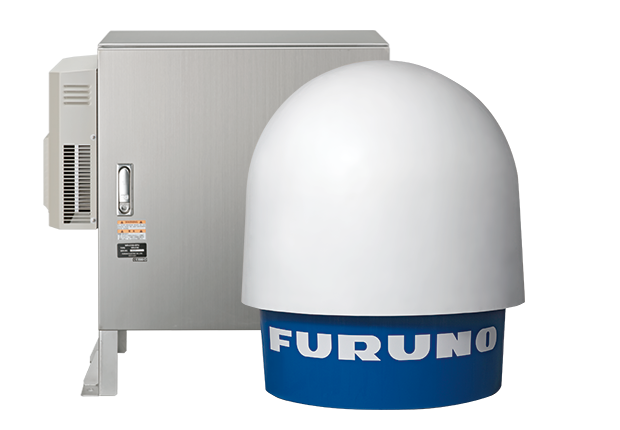
The WR2120 is Furuno's most advanced X-band Doppler weather radar, and the one we put forward for offshore weather and squall monitoring. Dual polarisation gives attenuation correction, more observation capability and higher precision for local weather, and the Doppler measurement gives accurate radial wind velocity.
- Dual polarisation with simultaneous transmission and reception (STAR), measuring the size and shape of what it sees
- Recovers the intensity loss and attenuation that heavy rain causes, for increased accuracy
- High sensitivity and high spatial resolution, with detection of rainfall and radial wind
- Classifies rainfall type and intensity, wind and turbulence, and identifies rain, snow and hail
- Solid-state transmitter and carbon fibre dish, for high reliability, long life and low maintenance cost
- Among the lightest and most compact Doppler weather radars on the market, with no heavy machinery needed to install it
- Redundant twin-antenna configuration available where the picture has to stay up
- UHD video-over-IP interface supplied as standard
It can run on its own for local observation or as part of a multi-radar network, and outputs data in open formats (Binary, CSV, JPG, CF/Radial, ODIM HDF5, NEXRAD Level 2) for third-party tools. WR2120 datasheet (PDF)
observation radius
full volume scan
Doppler velocity range
typical power consumption
What the WR2120 can show
Dual polarisation gives the WR2120 a wider set of output data than a single-polarisation radar, for viewing in Furuno's RainMap software or in third-party analysis tools.
Reflectivity (Zh)
How intense the rain, hail or snow is, in dBZ.
Doppler velocity and width
Radial wind velocity and how fast precipitation is moving towards or away from the radar, in m/s.
Rainfall intensity
Rain intensity as a rate, in mm/h.
Differential reflectivity (ZDR)
Compares the horizontal and vertical returns to measure the shape of what the radar sees.
Correlation coefficient (ρhv)
How uniform the particles are, from the correlation between the two polarisations.
Differential phase (ΦDP and KDP)
The phase difference between the two polarisations, used with echo strength to assess what the particles are.
Rain, snow or hail
Particle classification from the dual-polarisation data, so the crew knows what is falling.
Scan modes
PPI (a full 360° sweep), volume scan, sector PPI and sector RHI (a vertical cross-section).
Easy to install
No heavy lifting
Antenna unit about 1 m and 65 kg. No heavy equipment is needed, and it can be carried through narrow spaces (800 mm) if disassembled.
Signal processing unit
Processes the raw radar data. 45 kg.
Power
100 to 240 VAC, single phase, 50/60 Hz, compatible with a regular power outlet.
Remote access
The radar picture is available in a web browser on a PC or mobile device, over the internet.
Also available
Furuno WR110
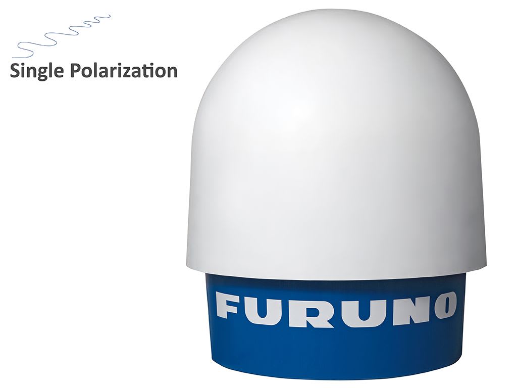
A cost-effective single-polarisation Doppler radar for sites where a simpler, lower-power radar meets the need. It uses the same antenna unit as the WR2120, runs from a regular power outlet at 200 W typical, and can run the Squall Warning Software. WR110 datasheet (PDF)
WR2120 and WR110 side by side
| WR2120 | WR110 | |
|---|---|---|
| Polarisation | Dual (horizontal and vertical), simultaneous | Single (horizontal) |
| Best suited for | Precise classification of rain type, intensity, wind and turbulence | Routine rain observation and cost-efficient stand-alone use |
| Band and range | X-band, 9.4 GHz, up to 70 km | X-band, 9.4 GHz, up to 70 km |
| Scan modes | PPI, volume scan, sector PPI, sector RHI | PPI, volume scan, sector PPI, sector RHI |
| Doppler speed | ±64 m/s | ±64 m/s |
| Measures | Reflectivity, Doppler velocity and width, rainfall intensity, plus ZDR, KDP, ΦDP and ρhv | Reflectivity, Doppler velocity and width, rainfall intensity |
| Heavy rain | Recovers intensity loss and attenuation caused by heavy rain | Rain attenuation correction |
| Precipitation type | Classifies rain, snow and hail | Not available |
| Antenna unit | About 1 m, 65 kg, carbon fibre dish | Same antenna unit as the WR2120 |
| Power consumption | 470 W typical, 650 W max. | 200 W typical, 350 W max. |
| Operating temperature | −25 to +50°C | −20 to +50°C |
| Wind survival | 90 m/s | 90 m/s |
Backup radar for critical operations
Where the radar picture or a squall warning decides whether a lift, a flight or an offloading goes ahead, a single radar is a single point of failure. For those operations we deliver a backup, so the picture stays up while one radar is serviced or has a fault.
Redundant WR2120
A twin-antenna configuration with dual signal and data processing, so one side keeps running while the other is down.
A second radar
For sites running two weather radars, a backup system keeps squall warnings running if one radar is out of service, and a second radar can cover the first one's blind areas.
Faults flagged, not missed
The radar monitors its own status, and system and sensor status is shown in DADAS, so the crew knows straight away if a radar stops delivering.
We help settle the configuration early, together with siting, because the second radar and its position are easiest to plan before installation.
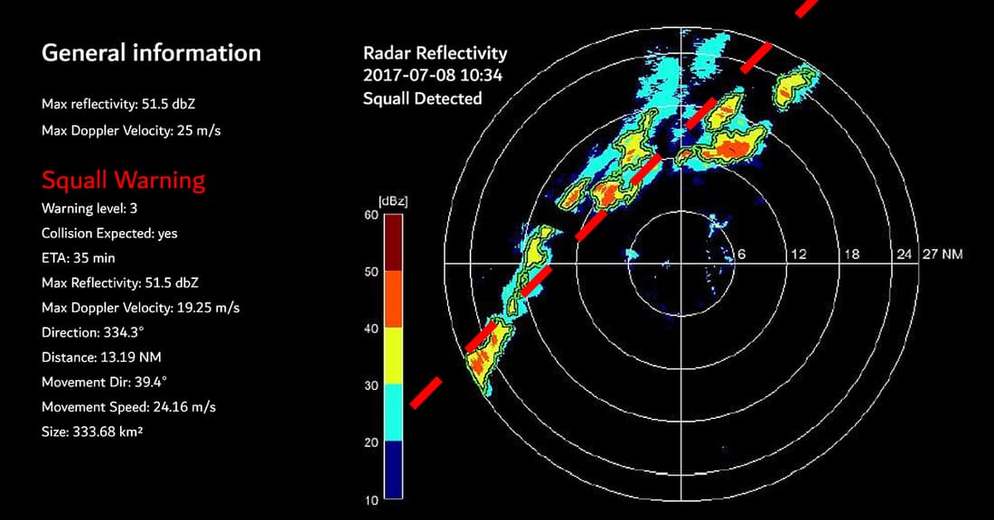
A squall line detected on the Squall Warning display. Image: Furuno.
Add-on for your weather radar
Turn the radar picture into an automatic squall warning
Radar imagery on its own still needs someone watching it. Add the Squall Warning System and the radar picture is analysed for you, with a warning raised when an organised squall line is on its way.
- New radar data analysed every five minutes, without operator input
- Four warning levels, set to your site and operations
- Warning level, ETA, direction, distance and speed of the squall
- Warnings and alarms in DADAS and on to your control systems
Where to next
Radar is one half of the storm picture; the other is lightning detection, which warns of the charge overhead before the first strike. Precipitation reaching the deck is measured by a rain gauge, and the radar output is displayed and logged alongside the rest of an environmental monitoring system.
Built on the radar: Squall Warning System
Related sensors: Lightning detection · Precipitation · All sensor types
Also useful: DADAS software · Service and support
In the knowledge base: Cleaning the weather radar radome
Useful to include
- The installation and where a radar could be sited
- The coverage you need, and whether one radar or two
- How the data should reach DADAS or your own systems
- Whether squall warnings are part of the scope
What happens next
Our engineers review the installation and what you need the radar to see.
We come back on the choice of radar, siting and backup.
You get a scope covering radar, integration, installation and service.
Get in touch
Tell us about the installation and what you need the radar to see. We will come back on the choice of radar, where it can be sited, backup for critical operations and how the data reaches DADAS or your own systems. You can also contact us directly.