

9 min read
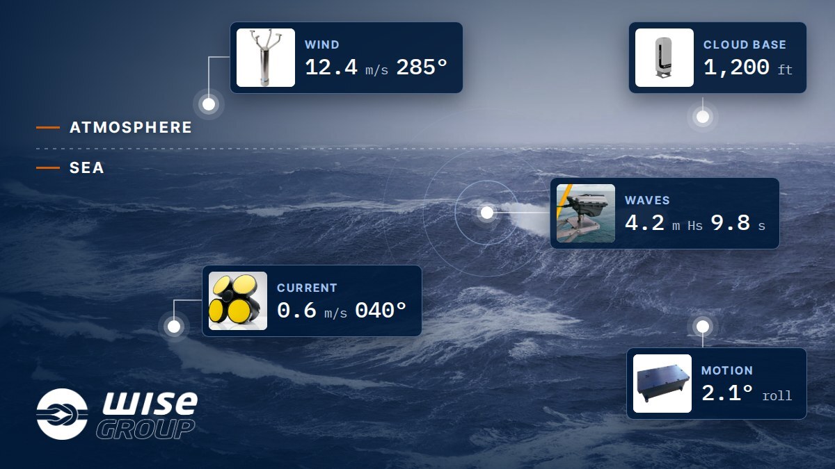
Every offshore operation has a weather limit. The wind speed that stops a crane lift. The wave height that keeps a crew transfer vessel alongside. The cloud base that decides whether the helicopter lands or turns back. When conditions are close to that limit, someone has to make the call, and they need readings from the site, not a regional estimate.
That is what an offshore environmental monitoring system is for. It measures the atmosphere, the sea and the movement of the asset itself, and puts the readings in front of the people making the decision. This post goes through what is measured, why each reading matters, and what separates a system you can rely on from a collection of sensors.
The short answer
- The atmosphere: wind speed and direction, air temperature, humidity, barometric pressure, visibility, cloud base, precipitation and solar radiation.
- The sea: wave height, period and direction, currents through the water column, tide and water temperature.
- The asset: motion in six degrees of freedom (roll, pitch, yaw, heave, surge and sway) on floating installations and vessels.
- Weather at range: a weather radar, where the operation needs warning of squalls before they arrive.
Most specifications ask for some of these, not all. In our experience a request comes in one of three shapes: meteorological only, oceanographic only, or the two combined. Which one depends on the asset, the operations it carries out and where in the world it is.
What is metocean data?
Metocean is short for meteorological and oceanographic. It is the combined picture of what the air and the water are doing at the site, right now and over time.
You will see the same system called many things: a metocean system, a weather station, a MET system, an Environmental Monitoring System (EMS). The name usually comes from whoever wrote the specification. What matters is the list of parameters it asks for and the decisions those parameters support.
What does the system measure in the atmosphere?
Wind
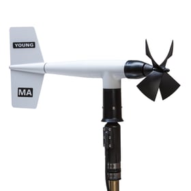
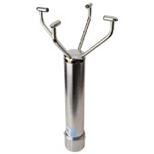
Wind is the reading almost every offshore activity depends on: crane operations, helicopter approaches, work at height, and whether people should be on deck at all. Wind sensors come as mechanical, ultrasonic or LIDAR types, and the choice depends on the site, the hazardous-area classification and what the data is used for.
Mechanical or ultrasonic is more than a matter of preference. A mechanical sensor rotates, so it shows you when the air around it is disturbed: it spins unevenly, stalls or swings about, and anyone on deck can see that the mounting is compromised. An ultrasonic sensor has no moving parts and gives no such clue. It keeps reporting plausible-looking values in turbulent air, so the problem has to be found in the data instead: how much the readings vary, the ratio of gusts to the mean, the scatter in direction and the quality flags.
On maintenance the trade-off runs the other way. The bearings in a mechanical sensor wear, so it needs periodic service and parts replaced over time. Nothing turns or wears in an ultrasonic sensor, which makes it the sensible choice on a high mast or anywhere access is difficult and expensive.
Whichever type it is, the location decides the quality of the reading. A structure disturbs the airflow further than most people expect. As a rule of thumb, the effect reaches about twice the structure's height upwind, several times its height downwind and up to twice its height above it. Deck structures, flare booms and the superstructure all do this, so where the sensor is mounted matters as much as which sensor it is. A wind reading taken in the wake of a module tells you about the module, not the weather.
Helideck standards also expect wind at a reference height, commonly 10 metres above the helideck, although the applicable authority sets the requirement. Many sites therefore carry more than one wind sensor. The system can compare them, or choose between them by wind sector, so a sensor masked by a known structure in one direction is not the one reporting for that direction. Where the ideal location simply is not available, the compromise is documented and checked on site against calibrated references. Our knowledge base explains why wind sensor location matters and what to do about it.
Temperature, humidity and pressure
Air temperature and humidity give dew point and heat stress for personnel safety. Barometric pressure, and especially how fast it is changing, is one of the earliest signs of approaching weather. These are covered on our meteorological sensors page.
Visibility and cloud base
A visibility sensor, such as the Campbell Scientific CS125, measures how far you can see and classifies the present weather, telling fog, haze and precipitation apart. A cloud height sensor, a LIDAR ceilometer such as the Campbell Scientific SkyVUE, measures the cloud base above the installation. Both are central to helicopter operations, which is why they appear in helideck standards.
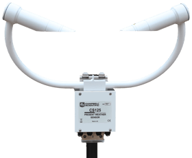
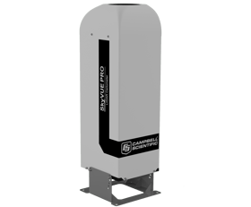
Both are optical, so they are only as good as their windows. Offshore, salt builds up on them gradually, along with dust, insects and bird droppings, and often without triggering an alarm. A dirty window gives a reading that looks fine and is not. Routine inspection and cleaning by the crew on site is part of operating them, and our knowledge base has the steps for the CS125 and the SkyVUE ceilometers.
Precipitation, solar radiation and weather radar
Precipitation and solar radiation sensors add detail for reporting. Where the operation needs advance warning of a rapid change, a weather radar shows the weather at range and is the basis for a Squall Warning System.
What does the system measure in the sea?
Waves
Wave height and period decide whether a crew can step across to a turbine, whether a lift over the side is safe, and how a floating installation will behave through the night. Period matters as much as height: a two-metre swell with a long period moves a vessel very differently from a two-metre wind sea.
On an offshore installation the wave sensor is usually a radar, so nothing sits in the water to foul, moor or lose. Which radar is right depends on what is underneath it.
A downlooking radar, such as the Radac WaveGuide, looks almost straight down and measures the distance to the sea surface. It is simple and well proven, and it suits an open structure such as a jacket or a substation, where the water below the sensor is clear. It does need that clear view: splash, wake off the structure and anything in the beam all corrupt the reading. A single unit gives height and period, and an array of three resolves direction as well.
A large FPSO rarely offers that spot. The hull is in the way, and the water alongside is disturbed by the vessel itself. Here a radar such as the Miros SM-050 is the better choice. It looks out and away from the structure, at sea the vessel has not disturbed, and reports wave height, period and direction together with surface current. On a moving hull, the motion-compensated version carries a motion reference unit to take the vessel's own movement out of the measurement.
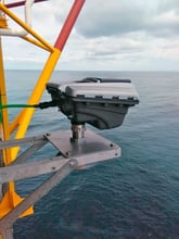
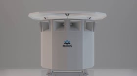
Whichever type it is, the mounting position is part of the specification, not an afterthought. More on the options on our wave sensors page.
Currents
Currents bear on mooring integrity, riser management, subsea work and, on an FPSO, offloading. An acoustic Doppler current profiler (ADCP) measures current speed and direction, and on an FPSO two kinds often work side by side.
A vertical ADCP looks down through the water column and typically profiles the current to beyond 1,000 metres, although how far it reaches depends on the water at the location. That is the picture behind mooring analysis, riser management and subsea planning.
A horizontal ADCP (H-ADCP) looks out and away from the FPSO instead, measuring the current in the water near the surface. It earns its place during offloading. When the tanker arrives and connects, the wind and the surface current can push it one way while the current further down pulls another. And the tanker does not stay the same: as it loads, it sits deeper in the water, more of its hull reaches into that deeper current, and its behaviour changes as the operation goes on. Measuring the surface current alongside the profile below lets the team see that difference before it affects the offloading.
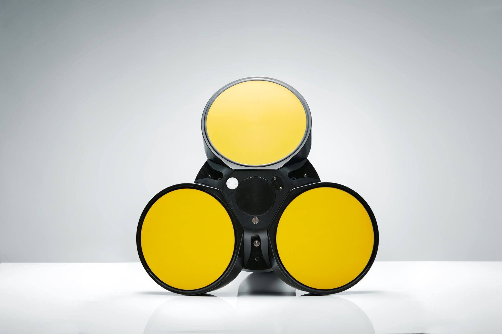
For a measurement at one chosen depth, for example close to a structure, a single-point acoustic current meter does the job. More on all of these on our current sensors page.
Getting instruments in and out of the water safely
A current profiler measures nothing until it is in the water at the right depth, and it stops being useful once it is fouled. So it has to go over the side, hang steady at depth, and come back on deck for cleaning, servicing and battery changes, all from an installation that is working. Done with ropes and improvisation, that puts both the instrument and the people handling it at risk.
A launch and recovery system (LARS) turns it into a routine job, without a crane spread or a dive team. The instrument sits in a protection frame on a boom and is lowered and recovered on a stainless-steel wire rope and umbilical by a hydraulic winch, so the movement is controlled in both directions.
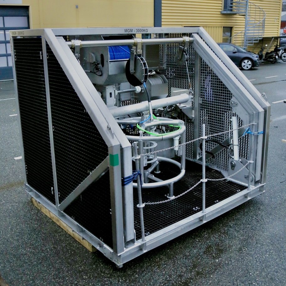
- For the people: lifting arrangements to DNV requirements, fail-safe operation, and servicing done on deck in a safe working position rather than leaning over the side. Ex Zone 2 versions are available for hazardous areas.
- For the instrument: a crash frame that protects the sensor against the hull or structure, measured lowering and recovery, and AISI 316 stainless steel for a long life in seawater.
This matters more than it sounds. A profiler that is awkward to recover is a profiler that stops being serviced, and then its readings stop being worth trusting.
Why measure the motion of the asset?
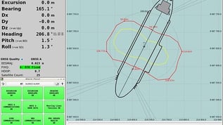
On an FPSO, a drillship or a floating wind foundation, the deck moves. That movement decides whether a helicopter can land, and it feeds dynamic positioning support and structural assessments. Motion sensors measure roll, pitch, yaw, heave, surge and sway.
Our own WISE AIM motion sensor (Advanced Inertial Measurement) is built on a multi-IMU architecture and sits inside many of the systems we deliver.
How does the data support helideck compliance?
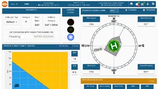
A Helideck Monitoring System uses the same sensors and presents what the helideck standard requires: wind, visibility, cloud base, pressure and, on a floating installation, deck motion. The standard depends on where the installation is. CAP 437 applies in the UK, BSL D 5-1 in Norway and NORMAM-223 in Brazil. For the UK we deliver to CAP 437 Edition 9 and to HCA Rev 9c, the pairing often referred to as CAP 437 9c.
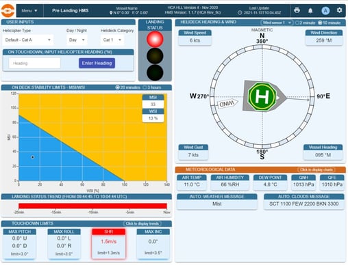
One thing worth knowing: these regimes are not interchangeable. An installation is configured to the standard that applies to it, not to all of them at once. Even small details differ. Aviation wants wind in knots, where a metocean display usually shows metres per second.
What turns sensors into a system?
Sensors alone do not improve a decision. A reading nobody trusts is worse than no reading at all.
A common way to deliver a metocean scope is to buy the sensors and take each vendor's own software with them. On paper that is a metocean system. In practice it is five software packages, five displays and five separate data records. Someone on board has to put the picture together, usually at the moment they have the least time to do it.
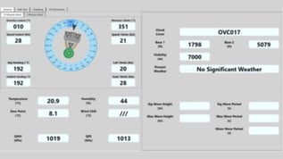
We build it the other way round. We develop our own software and integrate the sensors into one system. DADAS handles acquisition, display, alarms against operational limits, logging, and reports such as METAR and SYNOP. Data can also go to Orbalux, our cloud platform, so onshore teams see the same readings, and a forecast provider of your choice can use the measured site data in their forecasts.
Then the system has to stay accurate. Sensors drift, get fouled and get knocked. Planned service and verification over the life of the asset is what keeps the data worth acting on.
Frequently asked questions
What does an offshore environmental monitoring system measure?
Wind speed and direction, air temperature, humidity, barometric pressure, visibility, cloud base, precipitation and solar radiation in the atmosphere; wave height, period and direction, currents, tide and water temperature in the sea; and motion of the asset on floating installations. A weather radar can be added for squall warning.
What is metocean data used for?
Go/no-go decisions for helicopter landings, crane lifts, crew transfers, offloading and diving, and the long-term record behind regulatory reporting, incident investigation and site design criteria.
Why is wind hard to measure on an offshore platform?
The installation disturbs the airflow around it. Cranes, flare booms and modules create wakes and turbulence that reach well beyond the structure itself, so the sensor position has to be chosen carefully, and corrected where needed, for the reading to reflect the real wind.
Should I choose a mechanical or an ultrasonic wind sensor?
It depends on the site and what the data is for. A mechanical sensor rotates, so turbulence at the mounting is easy to see on deck, but its bearings wear and it needs periodic service and replacement parts over time. An ultrasonic sensor has no moving parts, so nothing wears out, which suits a high mast or a location that is hard to reach. The trade-off is that it keeps reporting plausible values in disturbed air, so its data has to be checked for turbulence instead. Either way, the location matters more than the type.
Why do visibility sensors and ceilometers need cleaning offshore?
They measure through optical windows. Salt, dust, insects and bird droppings build up on those windows gradually, often without triggering an alarm, and a dirty window gives readings that look normal but are not. Routine inspection and gentle cleaning by the crew on site keeps them reliable between service visits.
Which wave radar suits my installation?
It depends on what is below the sensor. A downlooking radar suits an open structure such as a jacket or substation, where the water below is clear. On a large FPSO, where the hull is in the way, a radar that looks out and away from the structure is the better choice.
What is a horizontal ADCP used for on an FPSO?
It measures the current near the surface, out and away from the hull. During offloading, that surface current, together with the wind, can act on the tanker differently from the current deeper down, and the difference grows as the tanker loads and sits deeper in the water.
Why use a launch and recovery system for a current profiler?
Because the profiler has to be lowered, held at depth and brought back on deck for cleaning and servicing, from a working installation. A LARS does that with controlled hydraulic handling and a protective frame, so neither the instrument nor the people handling it are put at risk.
Is a metocean system the same as a Helideck Monitoring System?
They share sensors, but they are not the same. A Helideck Monitoring System presents what the applicable helideck standard requires, in the form the helicopter operator needs. It is configured to one standard, such as CAP 437, BSL D 5-1 or NORMAM-223.
Where should I start when specifying a system?
Start with the operations that have weather or sea state limits, and who needs to see the readings. If you already have a specification, send it to us, whatever it calls the system. We will tell you which configuration it describes and what it needs to measure.